Sevilla to Merida an uneventful ride on the freeway in cool weather, 187kms in 2:05hrs.
On the road
Enter Merida
Once you get to the first Attraction you can buy a ticket for 16 Euro that will get you into a total of 8 places and that is what I did. There are many other bits of Roman buildings scattered all over the town.
Terre to Sevilla, a cold ride until I reached Puertollano and then a classic motorcycling road the N420 winding through the mountains and a couple of National Parks upto Montoro, 742kms in 7:56hrs, my rear end still need conditioning hahaha.
Sevilla is one of my favourite cities and I have visited it several times. This time I saw a couple of new places, the Hotel Alfonso XIII and the University.
Monumento a la Generación del Veintisiete
Híspalis Fountain
Catedral de Sevilla – Where C. Columbus is buried
Wine
Monumento a Fernando III El Santo
Lunch
.
Shades
Pastries
Carriages
Hotel Alfonso XIII
Hotel Alfonso XIII – The Lift
The Beer
Wedges
The Ceiling
The University
The University – many courtyards
The University – many courtyards
The University – many courtyards
The University – many courtyards
Gold Tower
Food
Choc Brownie – Very good
I discovered that Sevilla has Street Art, so I went Mural hunting in one particular area where they are concentrated.
An unexpected surprise was a religious procession that usually happens during Easter.
Toulouse to Terre in Spain should have been a great ride over the Pyrenees but it rained and it was miserable and nerve wracking through the mountains and of course there were many tunnels, 484kms in 7:10hrs.
Oftringen to Clermont-Ferrand in France, a long and tiring ride 535km and 7:50hrs, just passing through.
Heading out
Swiss Roundabout Art is Amazing
Spot the Train
The View
Back roads
Back roads
Cows
Roudabout
Enter France
The River between Switzerland and France
Mama and Baby
Flat for a change
Pizza Bread
Bolognaise
Chocolate Gelato
Clermont-Ferrand to Toulouse 399kms in 4:45hrs on the back roads, raining at first and then it became fine. Another stop to meet a friend. I visited Toulouse in 2015 for a few days, they have some spectacular mechanical animals.
A quick visit to Switzerland to catch up with a friend. Warm 31c, 195km took 3:15hrs over the back roads, nice ride through beautiful countryside and a few tunnels.
This is my regular commute from Hastings to Veghel to visit friends, the truck traffic around Antwerp is still a nightmare and the price of petrol has gone up a little.
Heading out of Hastings
The Strand Gate, Winchelsea, where Spike Milligan is buried
The big day finally arrived my release from prison hahaha. I boarded a flight from Perth at 2345 and arrived in Hastings the following evening at 1700.
Perth Airport
Perth at Night
Interesting
Halfway there
-43c
Sunrise
Doha Airport
Doha Airport
Doha Airport
Doha Airport train
Doha Airport
Back in the Air
Airbus 380 wing sags when stopped
Coming in to land
A slight delay waiting to land
My bike has been lying idle for 2.5 years now and according to the experts on Google the fuel must be drained and the whole system flushed with fresh fuel or there would be dire consequences. I have never done any of this in the past and my bike just starts and runs on the fuel thats in it. I always fill it to the brim and disconnect the battery before putting it into storage. But this time due to the extended time period I siphoned 8 litres of fuel (tank capacity 20 litres) out and replaced it with fresh fuel and added 125ml of Redex fuel injection cleaner as a precaution. One push of the started button and it purred into life, no worries. I also replaced the Battery and fitted new Metzler Tyres. Next insurance where I was completely ripped off. Because my bike has not been insured for over two years my No Claim Discount was set back to zero and I finished up paying over £400 for 12 months of 3rd party insurance. Anyway the MOT which is the annual roadworthy check went smoothly, no problems but advised to replace the Steering Head bearings next year, they have taken a beating. Finally the Licence Fee or Registration tax which has gone up from £55 in 2014 to £101 in 2022, now I am all set to go. Time for an Ale or two.
Started first time Hurray
We went for a drive and saw some interesting places. Eastbourne Pier, Beachy Head Cliffs, The Village of Blackboys, if this was in Australia it would have to be renamed Grass Tree Village hahaha.
Eastbourne Pier
Beachy Head, falling into the sea
Beachy Head
Blackboys Village
Blackboys Village
Blackboys Village
Blackboys Village
Blackboys Village
Heathfield Tavern where beer now costs nearly £5/pint – INFLATION
To cut a long story short, I got to Darwin and 2 days later received a message from the Western Australia Police that the quarantine requirements for entry from the Northern Territory had been lifted. Therefore I could enter the state without going into quarantine in Kununurra at the border and getting a negative Covid test as long as I had only been in the Northern Territory for the previous two weeks.
All the remote areas that I planned to visit in the Kimberley this year that I missed out on last year were still closed to outsiders. So I headed straight back to Perth before there were any more intrastate or interstate lockdowns. A disappointing end to a memorable trip.
Darwin to Kununurra – Distance 815 km, Elapsed time 8:50 hrs.
Stopped at Katherine for fuel after that rugged, beautiful and varied scenery. Another 15 min stop at the WA border while they checked my Visa and Checkin App to see where I had been in the last two weeks.
Around Australia by 4×4 2021
Road works
Cattle transport
The view
Army
Army
Rugged
.
Red cliffs
.
Timber Creek
.
.
Western Australia Border
Kununurra to Willare Bridge Road House – Distance 878 km, Elapsed time 8:39 hrs.
Two stops for fuel, Halls Creek and Fitzroy Crossing. Wildflowers are out now.
Heading out of Kununurra
.
.
.
.
.
.
.
.
Fitzroy River
Wildflowers
Wildflowers
.
.
Willare RH to South Hedland – Distance 706 km, Elapsed time 7:19 hrs.
This is where the caravans start as most of them are either coming from or going to Broome but once I got past the early leavers it was an uneventful drive to Hedland.
A Girl
A Fat Boy
A Bush Fire
Out for a morning ride
Wide Load
Wider Load
Turtle Head
South Hedland
South Hedland to Carnarvon – Distance 857 km, Elapsed time 8:18 hrs.
Many wildflowers, very beautiful.
Hazy
.
Wildflowers
.
.
.
.
.
Fine red sand
Carnarvon to Perth – Distance 907 km, Elapsed time 8:59 hrs.
Wildflowers up to Geraldton, after that it became colder and the wildflowers will start a month later.
From Mungerannie I continued on the Birdsville Track South to Marree and then turned onto the Oodnadatta Track heading North-West to William Creek. I filled up at William Creek and turned East onto the William Creek Road which goes through the Woomera Rocket Range, a vast area bigger than some countries used by the Military and finishes up at Coober Pedy. I was not planning to stop at Coober Pedy but when I was filling up I noticed a bulge in the left rear tyre which is just below the fuel inlet. Next stop a tyre shop and they said the tyre was damaged and could not be fixed and should be changed confirming my suspicions. They did not have the tyre that I wanted so I decided to swap it for the spare tyre. This is a time consuming task so I decided to stay the night. First I had to half empty the boot to get at the bolt that lowers the spare tyre to the ground. Next get the tools out and loosen the wheel nuts, then jack the car up, I brought a thick piece of timber with me just for this purpose (never thinking I would have to use it hahaha) so the jack would have a stable platform. Next remove the tyre and put the new one on and do up the wheel nuts until they bottom out, do not tighten or you might accidentaly roll the vehicle off the jack. Lower the jack and remove, then tighten the wheel nuts fully. Next secure the damaged tyre and reload the boot. Retighten the wheel nuts after driving a few hundred kilometers.
The damage to the tyre is called Staking and happens when you brush past bushes on the very narrow tracks which happens all the time and they either puncture the sidewall completely or thankfully in my case just damage the outer layer. One of the reasons I bought Falken tyres was because they have 2 ply sidewalls, most tyres only have one ply sidewalls and they are punctured more easily. This must have happened in the Simpson Desert and I did not notice because I did not check the tyres and therefore left myself open to a blowout on the road.
Heading out of Mungerannie
Water
On the right track
The View
Art
Railway Bridge
Road damage markers
Floodway
1 dog, 2 humans, 6 camels
Road Conditions
Military Land
Coober Pedy
Tyre Damage
Jack
Nearly done
I visited Coober Pedy in 2001 on my bike and remembered the spaceship which was left over from Pitch Black (2000), it is still there.
The next day I drove North to Alice Springs on the Stuart Highway and was stopped at the NT border because someone sneezed in South Australia but after I explained that I had only been in the desert I was allowed to pass.
Pitch Black Spaceship 2000
Pitch Black Spaceship 2021
Underground because its too hot above ground
Small Opal Mines
Big Opal Mines
Border Police
Since I had been to South Australia I had to remain in the Northern Territory for 14 days before I could head for home in Western Australia or I would have to quarantine for 14 days after crossing the border. At that point in time WA considered NT a safe state but not SA, the plot thickens later on hahaha.
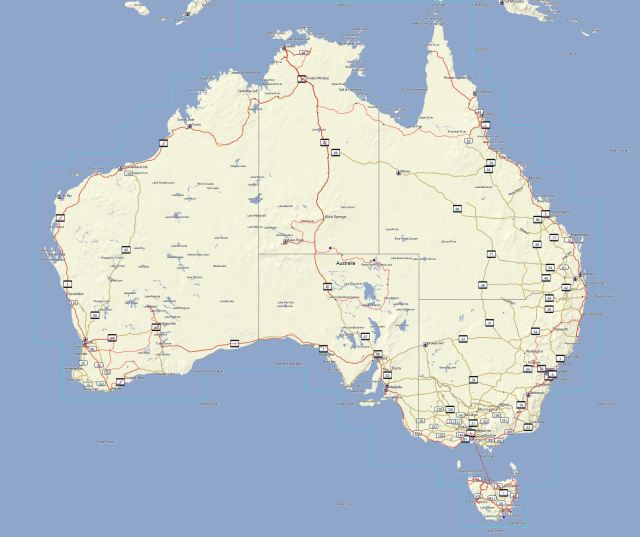
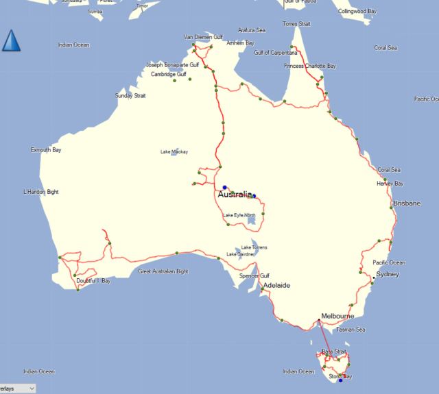
In order to get back into WA the state I have lived in for most of my life I had to apply for a visa called a G2G Pass. Upon reading the fine print I saw that there are only two entry points by road, Eucla in the South and Kununurra in the North. So if I decided to stick to my plan to drive through the Tanami desert on the Tanami Road it would cost me $50,000 and possibly a jail sentence. Change of plans, head North and kill time at stops along the way hahaha.
I applied for my Visa and it was granted immediately because I am a resident of WA, subject to meeting all the quarantine requirements if required. Non residents are not allowed in unless they have proof that they can eradicate all Viruses, Cancer and World Poverty.
Next stop Tennant Creek, I stopped here twice in 2001 just for the night, this time two nights, not exactly a tourist hot spot. The lady at the Caravan Park said most of their units are closed because they can not get anyone to clean them and the streets and parks are lined with locals lounging around.
Tropic Of Capricorn again
Art
Tennant Creek Hill Lookout
Community News
Art
Art
Art
Art
Accommodation
Dunmarra Wayside Inn for three days, in the middle of nowhere with a generator that stops working every now and then hahaha. They are famous for the meat pies and sausage rolls they bake on the premises.
Big Cricket
Art
Burger
Maet Pie
Order here
Story of the Name
Recipes
Road Train
Next stop Manbulloo Station 12 km East of Katherine, from there I planned to go to Timber Creek and then across the border to Western Australia. But two days before I was due to depart they discovered one case of Covid in Darwin and lockdown for 4 days. Now the Northern Territory which was a clean state became an unclean state to the WA authorities. Therefore I would have to quarantine immediately I crossed the border and get a Covid test, wait 3 days and if the result was negative I could proceed.
The problem is Kununurra which is the only town across the border has 4 small government approved quarantine hotels and they are all fully booked. Therefore if you arrive at the border without a booking you will be turned back and not allowed to enter the State hahaha. The earliest booking I could get in Kununurra was 01 September 2021 for the required four days. So I decided to go to Darwin and wait there for eleven days instead of at the Homestead where I had already been locked down for ten days.